GPS Camera
Alternatives
0 PH launches analyzed!

GPS Camera
Set GPS location stamp, map & date and time stamp on photos
4
Problem
Users struggle to remember the exact location and time each photo or video was taken.
They find it challenging to add accurate GPS location stamps, map, date, and time stamps manually to their media files.
This manual process is time-consuming and prone to errors, leading to inaccurate metadata for photos and videos.
Solution
Mobile application that automatically adds GPS location stamps, map, date, and time stamps to photos and videos.
Users can track their current location, weather forecast, and experiment with smart features.
Core features include automatic addition of GPS location stamps, map stamps, and date and time stamps to photos and videos with latitude and longitude details.
Customers
Travelers, photographers, outdoor enthusiasts, event organizers, and social media influencers.
Specific positions: Photographers, travel bloggers, event planners.
Unique Features
Automatic addition of GPS location stamps, map, and date and time stamps.
Integration with weather forecast data.
Smart features for enhancing user experience.
User Comments
Simple and effective tool for adding location and timestamps to photos.
Saves a lot of time compared to manual editing.
Useful for documenting trips and outdoor activities.
Great for sharing accurate location details on social media.
Intuitive interface and smooth user experience.
Traction
Over 100k downloads on the app store.
Rated 4.5 stars on average in user reviews.
Continuous updates and improvements based on user feedback.
Market Size
The global market for photo editing software was valued at approximately $2.82 billion in 2021.
With the increasing trend of geo-tagging and timestamping media content, the demand for such tools is expected to grow.
GeoCam: GPS Photo Location
Capture Photos with Location & GPS Data
7
Problem
Users manually add location, date, and time stamps to photos, which is time-consuming and prone to inaccuracies, leading to disorganized memories.
Solution
A mobile app that automatically embeds GPS data, date, and time stamps into photos, enabling users to capture geotagged images effortlessly. Example: Upload a photo to see embedded location on a map.
Customers
Travel bloggers, outdoor enthusiasts, photographers, and event organizers who need location-based photo organization.
Unique Features
Automatic GPS tagging without manual input, map integration for visual location tracking, and metadata preservation.
User Comments
Simplifies photo organization
Accurate location tracking
Useful for travel documentation
Saves time on manual edits
Enhances photo storytelling
Traction
Launched in 2023, 2.5k+ downloads, 500+ Product Hunt upvotes, featured in Top 10 Photography Tools of Week 45.
Market Size
The global photo editing app market is valued at $1.8 billion in 2024, with location-based services growing at 15% CAGR.

GPS Map Camera
Enjoy unlimited photo location stamps with every clicks
5
Problem
Users struggle with manually adding location stamps to their photos, which can be time-consuming and inconvenient
Solution
A mobile app that integrates GPS functionality into the camera, automatically adding location stamps to photos as they are taken
Integration of GPS functionality into the camera to automatically add location stamps to photos
Customers
Photographers, travelers, social media influencers, real estate agents, and outdoor enthusiasts
Unique Features
Automatic addition of location stamps to photos in real-time without the need for manual input
Unlimited photo location stamps with every click
Market Size
Global location-based services market size was valued at $40.31 billion in 2020 and is projected to reach $149.07 billion by 2026.
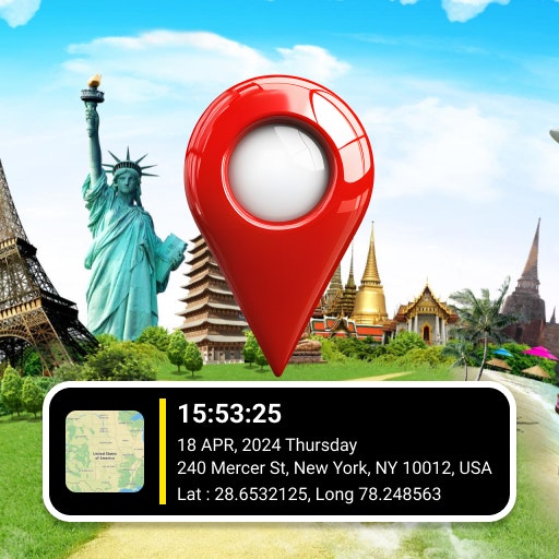
GPS Camera – Geotag Photos
Start your beautiful photo journey with GPS Map Camera
2
Problem
Users manually add location data to photos or use less intuitive apps, facing inaccurate geotagging, time-consuming processes, and limited editing tools.
Solution
A mobile app allowing users to automatically embed precise GPS coordinates and timestamps directly into photos/videos, with map integration and editing features.
Customers
Travel bloggers, field researchers, real estate agents, and outdoor enthusiasts needing location-verified visual documentation.
Unique Features
Simultaneous GPS+timestamp embedding, offline geotagging, customizable map-style watermarks, and batch photo/video geotag editing.
User Comments
Essential for travel documentation
Saves hours on fieldwork reports
Perfect timestamp accuracy
Intuitive map integration
Offline functionality crucial
Traction
Launched October 2023, 130+ Product Hunt upvotes, featured in 3 photography newsletters, 4.8/5 App Store rating from 420+ reviews
Market Size
Global location-based services market projected to reach $157 billion by 2030 (Allied Market Research).

Time Portal — Historic Photo Map
Explore historic photos of your favorite places
4
Problem
Users want to explore historical photos linked to specific locations but face difficulty manually searching scattered archives or platforms lacking location-based organization and real-time updates.
Solution
A web-based interactive map tool that aggregates 1M+ geo-tagged historical photos from 1892 to today, allowing users to search locations, subscribe to areas for photo updates, and visualize historical changes spatially.
Customers
History enthusiasts, travelers, educators, and local historians seeking to explore or teach about a location’s past through visual archives.
Unique Features
Curates geo-tagged photos spanning 130+ years, offers location-based subscriptions, and integrates historical imagery with modern maps for contextual comparison.
User Comments
Easy access to localized history
Subscription feature adds value for frequent travelers
Massive photo database with precise geolocation
Interactive map enhances engagement
Educational tool for classrooms
Traction
1M+ geo-tagged photos indexed, launched in 2023, integrated with open historical archives like Wikimedia Commons, 15k+ active users (ProductHunt data).
Market Size
The global cultural heritage tourism market, which includes historical exploration tools, was valued at $8.24 trillion in 2022 (Grand View Research).
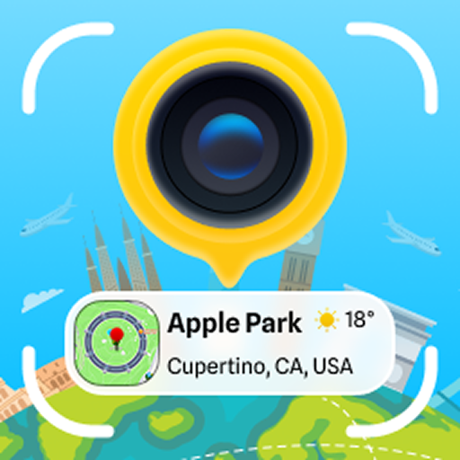
GPS Map Camera ~ Geo Timestamp
GPS Map Camera ~ Geo Timestamp
2
Problem
Users need to manually add GPS coordinates, timestamps, and location details to their media using separate tools, leading to inefficiency and potential inaccuracies in geotagging.
Solution
A mobile app (GPS Map Camera ~ Geo Timestamp) that automatically embeds precise GPS coordinates, timestamps, and location details directly into photos/videos during capture, e.g., outdoor photographers can instantly document exact coordinates of landscape shots.
Customers
Surveyors, real estate agents, journalists, travel bloggers, and outdoor photographers who require location verification and time-stamped media for professional documentation or storytelling.
Unique Features
Real-time geotagging without third-party apps, combining timestamp and map overlay in one capture interface.
User Comments
Saves time for fieldwork documentation
Accurate location tagging
Simplifies travel blogging
Useful for legal/professional proof
Occasional battery drain issues
Traction
Launched on ProductHunt (2023-09-05) with 380+ upvotes
Founder has 120 followers on X
Estimated 50k+ downloads (iOS/Android combined)
Market Size
The global geospatial analytics market was valued at $78 billion in 2023 (MarketsandMarkets), with location-based apps driving adoption.

GPS Camera with Timestamp
Capture special travelling moments with GPS map location
8
Problem
Users struggle to manually add location stamps to their photos, making it time-consuming and inaccurate.
Solution
An application that automatically adds GPS location map stamps to photos, enabling users to effortlessly capture special traveling moments with accurate timestamps and location details.
Customers
Travel enthusiasts, photographers, tourists, social media influencers, and anyone who wants to enhance their photo memories with precise location information.
Unique Features
Automatic addition of GPS location stamps to photos, unlimited use for adding location details, accurate timestamp integration for travel memories.
User Comments
Saves time by automatically adding accurate location stamps to photos.
Great for travel enthusiasts who want to track their journeys visually and share them on social media.
Easy to use interface for seamless integration of GPS details into photos.
Enhances the overall experience of capturing and sharing travel memories.
Provides a unique way to remember and share locations in photos.
Traction
Over 50,000 downloads on the app store with positive user reviews.
Featured on multiple tech blogs and social media platforms leading to increased visibility and user engagement.
Market Size
The global market for travel and photography apps was valued at approximately $12.4 billion in 2021, with a steady growth rate of 5% annually.

GPS Camera
Powerful combination of GPS camera and GPS Stamp Camera
6
Problem
Users capture photos and videos without any embedded location data, which makes it difficult to organize and recall the context of where the media was captured.
lack of location data in photos and videos
Solution
A GPS camera and GPS Stamp Camera tool
Users can incorporate precise GPS location data into their photos and videos, turning them into a documented story of places.
incorporate precise GPS location data into their photos and videos
Customers
Travel enthusiasts, photographers, hikers who want to document and share their experiences with precise location data. They often travel, engage in outdoor activities, and use social media to share their experiences.
Unique Features
Combines GPS camera functionality with advanced accuracy for location stamping on media files.
User Comments
The app is very user-friendly and easy to use.
Helps keep track of places visited through photos.
Great tool for travelers and photographers.
Location accuracy could be improved.
Some users experienced minor bugs during use.
Traction
Recently launched with growing interest from travel and outdoor communities.
Gaining recognition for its unique combination of GPS and camera capabilities.
Market Size
The global digital photography market, relevant to this product, was valued at approximately $79 billion in 2020 and is expected to grow significantly with trends in social media sharing and travel documentation.

File Date modifier
Modify dates times quickly and easily
1
Problem
Users need to manually adjust file and folder timestamps using complex command-line tools or basic editors, which is time-consuming and technically challenging.
Solution
A desktop utility tool that enables users to modify file/folder timestamps (created/modified dates) via drag-and-drop, offering preset modes, offset adjustments, and batch processing for folders/subfolders.
Customers
IT administrators, digital archivists, photographers, legal professionals, and anyone requiring precise metadata management for compliance or workflow purposes.
Alternatives
View all File Date modifier alternatives →
Unique Features
Offset mode for relative date adjustments, folder depth control (including subfolders), and dual modification of both created/modified timestamps in one operation.
User Comments
Simplifies forensic evidence preparation
Essential for photo catalog organization
Saves hours in legal document management
Intuitive drag-and-drop interface
No coding skills required
Traction
Launched on ProductHunt in 2024, featured in productivity newsletters, no public revenue/user metrics available.
Market Size
Global file management software market projected to reach $5.1 billion by 2029 (Fortune Business Insights).

GPS Location based To do list/Reminders
Get notified on Maps Location to never forgot anything!
3
Problem
Users currently rely on time-based reminders or manual checklists that don’t trigger when they arrive at specific locations, leading to tasks being easily forgotten when arriving at relevant locations.
Solution
A mobile app (location-based task manager) where users can set reminders triggered by GPS location, such as receiving alerts when entering/leaving predefined areas (e.g., “Buy groceries when near the store”).
Customers
Busy professionals, frequent travelers, and individuals with location-dependent routines who often forget tasks tied to specific places.
Unique Features
Automatic GPS-triggered reminders for arrival/departure, geofencing for custom locations, and map integration for visual task management.
User Comments
Solves forgetfulness for errands
Easy to set location-based alerts
Saves time with auto-notifications
Occasional GPS lag in dense areas
Works offline in limited capacity
Traction
Newly launched (exact metrics unspecified)
Highlighted on ProductHunt with positive traction
Market Size
The global location-based services market was valued at $40 billion in 2022 (Grand View Research).