


GPS Map Camera ~ Geo Timestamp
Alternatives
0 PH launches analyzed!
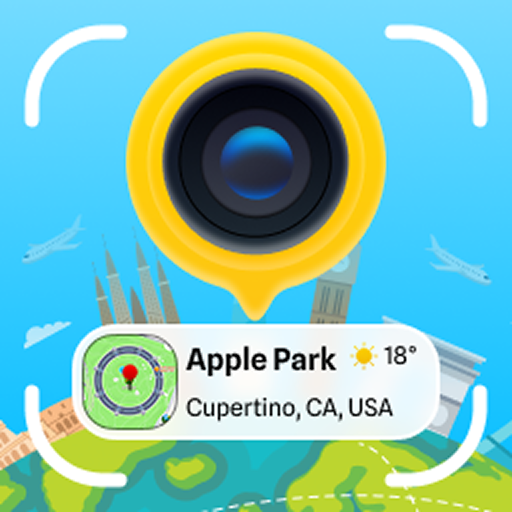
GPS Map Camera ~ Geo Timestamp
GPS Map Camera ~ Geo Timestamp
2

Problem
Users need to manually add GPS coordinates, timestamps, and location details to their media using separate tools, leading to inefficiency and potential inaccuracies in geotagging.
Solution
A mobile app (GPS Map Camera ~ Geo Timestamp) that automatically embeds precise GPS coordinates, timestamps, and location details directly into photos/videos during capture, e.g., outdoor photographers can instantly document exact coordinates of landscape shots.
Customers
Surveyors, real estate agents, journalists, travel bloggers, and outdoor photographers who require location verification and time-stamped media for professional documentation or storytelling.
Unique Features
Real-time geotagging without third-party apps, combining timestamp and map overlay in one capture interface.
User Comments
Saves time for fieldwork documentation
Accurate location tagging
Simplifies travel blogging
Useful for legal/professional proof
Occasional battery drain issues
Traction
Launched on ProductHunt (2023-09-05) with 380+ upvotes
Founder has 120 followers on X
Estimated 50k+ downloads (iOS/Android combined)
Market Size
The global geospatial analytics market was valued at $78 billion in 2023 (MarketsandMarkets), with location-based apps driving adoption.
GPS Camera - Geo Tagging
Make beautiful memories with GPS Camera – Timestamp Photos
3
Problem
Users need to manually add location, time, and weather data to photos/videos, requiring multiple apps and time-consuming editing
Solution
A mobile app that automatically embeds real-time GPS location, timestamp, weather, and maps onto photos/videos during capture
Customers
Travel bloggers, outdoor enthusiasts, real estate agents, and field researchers needing geotagged visual documentation
Alternatives
View all GPS Camera - Geo Tagging alternatives →
Unique Features
Integrated real-time metadata overlay (GPS, time, weather, address) without post-processing
User Comments
Simplifies travel documentation workflow
Essential for location-based content creation
Accurate weather/time stamps add context
Makes photo organization intuitive
No more manual data entry
Traction
Launched v3.2 with AR map overlays in 2024
500k+ downloads on Play Store
4.7/5 rating from 18k reviews
Featured in Google's 'Top Productivity Apps' 2023
Market Size
The global geotagging solutions market is projected to reach $5.8 billion by 2027 (CAGR 12.4%)
GPS Camera – Geotag Photos
Start your beautiful photo journey with GPS Map Camera
2
Problem
Users manually add location data to photos or use less intuitive apps, facing inaccurate geotagging, time-consuming processes, and limited editing tools.
Solution
A mobile app allowing users to automatically embed precise GPS coordinates and timestamps directly into photos/videos, with map integration and editing features.
Customers
Travel bloggers, field researchers, real estate agents, and outdoor enthusiasts needing location-verified visual documentation.
Unique Features
Simultaneous GPS+timestamp embedding, offline geotagging, customizable map-style watermarks, and batch photo/video geotag editing.
User Comments
Essential for travel documentation
Saves hours on fieldwork reports
Perfect timestamp accuracy
Intuitive map integration
Offline functionality crucial
Traction
Launched October 2023, 130+ Product Hunt upvotes, featured in 3 photography newsletters, 4.8/5 App Store rating from 420+ reviews
Market Size
Global location-based services market projected to reach $157 billion by 2030 (Allied Market Research).

GPS Camera with Timestamp
Capture special travelling moments with GPS map location
8
Problem
Users struggle to manually add location stamps to their photos, making it time-consuming and inaccurate.
Solution
An application that automatically adds GPS location map stamps to photos, enabling users to effortlessly capture special traveling moments with accurate timestamps and location details.
Customers
Travel enthusiasts, photographers, tourists, social media influencers, and anyone who wants to enhance their photo memories with precise location information.
Unique Features
Automatic addition of GPS location stamps to photos, unlimited use for adding location details, accurate timestamp integration for travel memories.
User Comments
Saves time by automatically adding accurate location stamps to photos.
Great for travel enthusiasts who want to track their journeys visually and share them on social media.
Easy to use interface for seamless integration of GPS details into photos.
Enhances the overall experience of capturing and sharing travel memories.
Provides a unique way to remember and share locations in photos.
Traction
Over 50,000 downloads on the app store with positive user reviews.
Featured on multiple tech blogs and social media platforms leading to increased visibility and user engagement.
Market Size
The global market for travel and photography apps was valued at approximately $12.4 billion in 2021, with a steady growth rate of 5% annually.

GPS Camera
Powerful combination of GPS camera and GPS Stamp Camera
6
Problem
Users capture photos and videos without any embedded location data, which makes it difficult to organize and recall the context of where the media was captured.
lack of location data in photos and videos
Solution
A GPS camera and GPS Stamp Camera tool
Users can incorporate precise GPS location data into their photos and videos, turning them into a documented story of places.
incorporate precise GPS location data into their photos and videos
Customers
Travel enthusiasts, photographers, hikers who want to document and share their experiences with precise location data. They often travel, engage in outdoor activities, and use social media to share their experiences.
Unique Features
Combines GPS camera functionality with advanced accuracy for location stamping on media files.
User Comments
The app is very user-friendly and easy to use.
Helps keep track of places visited through photos.
Great tool for travelers and photographers.
Location accuracy could be improved.
Some users experienced minor bugs during use.
Traction
Recently launched with growing interest from travel and outdoor communities.
Gaining recognition for its unique combination of GPS and camera capabilities.
Market Size
The global digital photography market, relevant to this product, was valued at approximately $79 billion in 2020 and is expected to grow significantly with trends in social media sharing and travel documentation.

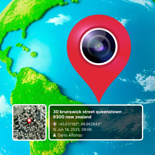
GPS Camera with Timestamp
Lightweight GPS camera with Timestamp app is a great choice
5
Problem
Users struggle to manually add location, date-time, weather, and compass details to their captured images, leading to time-consuming and unreliable image information.
Solution
Mobile app that allows users to embed GPS location, date-time, weather, and compass details directly into their captured images, providing an easy and reliable solution for businesses like Marine, Architecture, Farming, Military, Civil Engineering, etc.
Core Features: Embedding location, date-time, weather, and compass details into images.
Customers
Professionals in industries such as Marine, Architecture, Farming, Military, and Civil Engineering.
Unique Features
The ability to embed GPS location, date-time, weather, and compass information directly into images, catering to specific industry needs.
User Comments
Easy-to-use tool for adding crucial information to images.
Time-saving solution for businesses that require accurate image details.
Great for professionals working in outdoor or location-specific fields.
Reliable and accurate feature set for accurate image documentation.
Useful for a wide range of industries such as Marine, Architecture, Farming, Military, and Civil Engineering.
Traction
The app has gained popularity with professionals in Marine, Architecture, Farming, Military, Civil Engineering, and other related fields.
Positive user feedback on product functionality and ease of use.
Market Size
Global market for location-based image tools is growing rapidly, driven by increased demand for accurate image documentation across industries like Marine, Architecture, Farming, Military, and Civil Engineering.

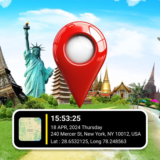
GPS Camera
Set GPS location stamp, map & date and time stamp on photos
4
Problem
Users struggle to remember the exact location and time each photo or video was taken.
They find it challenging to add accurate GPS location stamps, map, date, and time stamps manually to their media files.
This manual process is time-consuming and prone to errors, leading to inaccurate metadata for photos and videos.
Solution
Mobile application that automatically adds GPS location stamps, map, date, and time stamps to photos and videos.
Users can track their current location, weather forecast, and experiment with smart features.
Core features include automatic addition of GPS location stamps, map stamps, and date and time stamps to photos and videos with latitude and longitude details.
Customers
Travelers, photographers, outdoor enthusiasts, event organizers, and social media influencers.
Specific positions: Photographers, travel bloggers, event planners.
Alternatives
View all GPS Camera alternatives →
Unique Features
Automatic addition of GPS location stamps, map, and date and time stamps.
Integration with weather forecast data.
Smart features for enhancing user experience.
User Comments
Simple and effective tool for adding location and timestamps to photos.
Saves a lot of time compared to manual editing.
Useful for documenting trips and outdoor activities.
Great for sharing accurate location details on social media.
Intuitive interface and smooth user experience.
Traction
Over 100k downloads on the app store.
Rated 4.5 stars on average in user reviews.
Continuous updates and improvements based on user feedback.
Market Size
The global market for photo editing software was valued at approximately $2.82 billion in 2021.
With the increasing trend of geo-tagging and timestamping media content, the demand for such tools is expected to grow.

GPS Map Camera
Enjoy unlimited photo location stamps with every clicks
5
Problem
Users struggle with manually adding location stamps to their photos, which can be time-consuming and inconvenient
Solution
A mobile app that integrates GPS functionality into the camera, automatically adding location stamps to photos as they are taken
Integration of GPS functionality into the camera to automatically add location stamps to photos
Customers
Photographers, travelers, social media influencers, real estate agents, and outdoor enthusiasts
Unique Features
Automatic addition of location stamps to photos in real-time without the need for manual input
Unlimited photo location stamps with every click
Market Size
Global location-based services market size was valued at $40.31 billion in 2020 and is projected to reach $149.07 billion by 2026.

Street View Live Satellite Map
Explore world with satellite map, get route planner with map
4
Problem
Users rely on traditional maps for navigation, lacking real-time visuals and interactive features.
Solution
Mobile application offering live street view satellite maps and instant GPS navigation with advanced 3D features.
Provides real-time 3D street map views, full-screen street map zooming, and instant GPS navigation.
Customers
Travelers who need precise navigation and real-time views for exploring unfamiliar areas.
Unique Features
Real-time 3D street map views
Full-screen street map zooming
Instant GPS navigation
User Comments
Easy to use and provides accurate navigation
Great visuals and interactive features
Helpful for planning routes and exploring new places
Enhances the travel experience
Improves safety and efficiency in navigation
Traction
Over 100k downloads on Google Play Store
Positive user ratings averaging 4.5 stars
Market Size
Global navigation app market size was valued at $39.7 billion in 2021
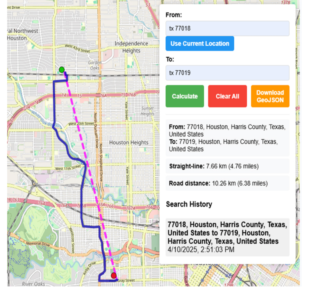
online map maker
freemaptools, gis, web map, mapping, build maps, geodata
3
Problem
Users need multiple specialized tools for different GIS tasks like viewing GPX files, calculating distances, and finding elevation data, leading to time-consuming and inefficient workflows.
Solution
A web-based GIS mapping platform that consolidates tools (e.g., GPX viewer, distance calculator, elevation finder) into one interface, enabling users to access all mapping features in a single platform.
Customers
Urban planners, logistics coordinators, environmental researchers, and field surveyors requiring frequent geodata analysis.
Unique Features
Comprehensive suite of 15+ free GIS tools integrated into one platform, eliminating the need for multiple subscriptions or software installations.
User Comments
Saves time by centralizing tools
Free access lowers entry barriers
User-friendly for non-experts
Useful for logistics route planning
Regularly updated features
Traction
50,000+ monthly active users, 4.7/5 rating on Product Hunt (300+ upvotes), freemium model with premium features generating $20k MRR
Market Size
The global GIS market is projected to reach $25.6 billion by 2030, growing at 12.1% CAGR (Grand View Research, 2023).