What is Compare Country Size?
Use our free interactive map size comparison tool to compare the actual size of any country. Try it now and see how big each country really is!
Problem
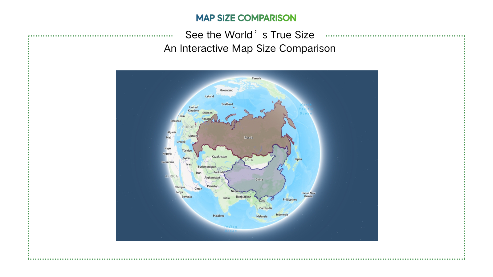
Users traditionally rely on standard 2D maps (e.g., Mercator projection) to compare country sizes, but these maps distort the actual size of countries, especially near the poles, leading to misconceptions (e.g., Greenland appearing larger than Africa).
Solution
An interactive map tool that lets users overlay countries on a single map to compare their true sizes accurately, using a distortion-corrected visualization method. Example: Compare Brazil vs. China with real-time scaling.
Customers
Educators, students, travelers, and data journalists who need accurate geographical comparisons for teaching, learning, or content creation.
Unique Features
Uses an equal-area projection to eliminate Mercator distortion, enables side-by-country overlays, and provides instant visual size comparisons with geopolitical boundaries.
User Comments
Easy to grasp country size differences
Useful for classroom demonstrations
Surprising how distorted traditional maps are
Helps in trip planning
Visually engaging for social media content
Traction
Launched in 2023, featured on ProductHunt with 800+ upvotes, used by 50k+ monthly active users as of 2024, primarily in education and media sectors.
Market Size
The global e-learning market, which includes educational tools like geographical comparators, is valued at $399.3 billion in 2024 (Source: Global Market Insights).