What is Advanced Satellite Image Processing?
Welcome to Advanced In-Browser Satellite Image Processing ⚡ Preset scripts: water, vegetation & more! 🏆 Super easy: create custom scripts, preview instantly 🤩 Share your maps with the world 🌏 Explore archives going back to 2016 + Its tariff free! 🤨
Problem
Users previously relied on separate software for satellite image processing, which required technical expertise and time-consuming workflows. Lack of preset scripts, difficulty in creating custom scripts, and limited accessibility hindered efficient analysis.
Solution
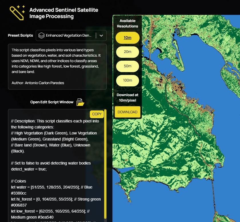
An in-browser tool enabling users to process Sentinel satellite imagery with preset scripts (water, vegetation) and create custom scripts instantly. Examples: generate maps, analyze historical archives (2016+), and share results globally.
Customers
Environmental scientists, geospatial analysts, agricultural planners, and urban developers needing accessible satellite data analysis for research, monitoring, or decision-making.
Unique Features
In-browser processing (no downloads), preset/custom script creation, instant previews, historical archive access (2016+), and tariff-free global map sharing.
User Comments
Simplifies satellite data analysis for non-experts
Instant script previews save time
Historical data access is valuable
Easy sharing enhances collaboration
No cost barriers compared to paid tools
Traction
Launched on ProductHunt with 180+ upvotes. Details on users/MRR unspecified; leverages Sentinel’s open data (used by 500k+ researchers globally).
Market Size
The global geospatial analytics market is projected to reach $96.3 billion by 2025, driven by demand in environmental monitoring and agriculture (MarketsandMarkets, 2020).